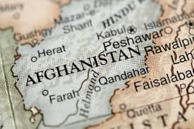
Brief Overview of Afghanistan’s Location in Asia
Afghanistan is a landlocked mountainous country situated on the Iranian Plateau. It lies at a critical crossroads, acting as a meeting point between Central Asia and South Asia. This position has made it a historical conduit for trade, culture, and, unfortunately, invasion. With an area of 652,864 km² (252,072 sq mi), it ranks as the 40th largest country in the world. Its capital, Kabul, is located in the Kabul Province and has historically been a focal point due to its placement along major trade routes. The country’s coordinates are 33°00′N 65°00′E, placing it in the heart of Asia’s continental landmass.
Geographical Location and Borders
Being landlocked is a fundamental aspect of Afghanistan’s geography, influencing its economy and international relations. It shares long and often rugged borders with six nations, totaling approximately 5,987 kilometers (3,721 miles) of frontier. The specific borders are:
- Pakistan: 2,670 km (1,660 mi) to the east and south.
- Tajikistan: 1,357 km (843 mi) to the north.
- Iran: 921 km (572 mi) to the west.
- Turkmenistan: 804 km (500 mi) to the north.
- Uzbekistan: 144 km (89 mi) to the north.
- China: 91 km (57 mi) in the narrow Wakhan Corridor in the far northeast.
Physical Geography of Afghanistan
The most dominant feature of Afghanistan’s physical geography is its mountains. They cover as much as 80 percent of the country’s total land area. The highest peak is Noshaq, at 7,492 meters (24,580 feet), located in the Hindu Kush range on the border with Pakistan. The lowest point is at the Amu Darya river near Khamyab, at just 258 meters (846 feet) above sea level. This extreme vertical relief—over 7,200 meters (23,600 feet) from lowest to highest point—is a key to understanding the country’s climatic variety and isolation of communities.
Hindu Kush Mountain
This is the most important mountain range in Afghanistan, considered an extension of the Himalayan Mountains. It stretches approximately 800 kilometers (500 miles) from central and eastern Afghanistan into northwestern Pakistan and southeastern Tajikistan. The range is not only a physical barrier but also a historical one. It was once a significant center of Buddhism, home to sites like the Bamiyan Buddhas, and hosted ancient monasteries and trade networks. Some areas, like the historical region of Kafiristan, retained ancient beliefs until the 19th century when they were converted to Islam and renamed Nuristan, meaning “land of light.” The Hindu Kush has also been a critical passageway for invasions into the Indian subcontinent and remains strategically important in contemporary warfare. Its high, snow-capped peaks, like Tirich Mir in Pakistan at 7,708 meters (25,289 ft), feed the country’s rivers. The mountain passes are of immense strategic value. These include the Shebar Pass, the Khyber Pass (which leads to the Indian subcontinent), and most importantly, the Salang Pass, which is vital for connecting Central and Southern Afghanistan to Northern Afghanistan. Furthermore, the northeastern Badakhshan area in these highlands is seismically active, experiencing the epicenters for many of the approximately 50 earthquakes that occur in the country each year.
Plains in Afghanistan
Outside the central highlands, Afghanistan has two main lowland regions: the Northern Plains and the Southwestern Plateau.
The Northern Plains: Located north of the Central Highlands, this region forms the country’s agricultural heartland, often called its “breadbasket.” It is characterized by rolling hills, plains, and fertile loess soils. The average elevation is about 600 meters (2,000 feet), dropping to as low as 183 meters (600 feet) in the Amu Darya valley. Beyond agriculture, this region is rich in mineral resources, particularly natural gas and oil deposits.
The Southwestern Plateau: This is a vast, arid region south of the Central Highlands, covering approximately 130,000 square kilometers (50,000 square miles). It consists of high plateaus and sandy deserts. The soil is generally infertile except along river valleys. The average altitude is around 900 meters (3,000 feet), sloping down to about 450 meters (1,500 feet) in the Sistan depression. The climate here is extremely arid, with frequent strong winds and sandstorms.
Deserts of Afghanistan
The Southwestern Plateau is home to two major deserts that exemplify the country’s arid extremes.
Registan Desert: Meaning “country of sand” in Persian, this arid plateau region features ridges and small hills of red sand. Sand dunes reach heights of between 50 and 100 feet (15 and 30 meters). The area is largely devoid of vegetation, with some parts becoming barren gravel and clay. It is used as winter pasture by Baluchi and Pashtun nomads who herd sheep, goats, and camels.
Dasht-e Margo: Translated as “Desert of Death,” this desert is even more forbidding. It is the world’s 20th largest desert, covering about 150,000 km², with an elevation of 500–700 meters. It consists mainly of rocky-clayish plains with salt flats (solonchaks), takirs (dry clay basins), and very few oases.
Rivers and Lakes
Afghanistan’s drainage system is almost entirely enclosed within the country. Only the rivers in the east, draining an area of 32,000 square miles (83,000 square km), eventually reach the sea. The major rivers are crucial for life and agriculture.
- Kabul River (east): The major eastern stream, it flows into the Indus River and then into the Arabian Sea.
- Amu Darya (north): This is a massive river, 1,578 miles (2,540 km) long. It drains about 93,000 sq mi (241,000 sq km) and forms Afghanistan’s northern border for about 600 miles (1,000 km). It becomes navigable 60 miles (100 km) west of Feyẕābād.
- Harīrūd (northwest): Originating at 9,000 ft (2,750 m), it flows past the city of Herāt and forms the Afghan-Iranian border for 65 miles (105 km).
- Helmand River (southwest): This is the longest river entirely within Afghanistan. With a course of ~715 miles (1,150 km), it and its tributaries drain over 100,000 square miles (259,000 sq km), ending in inland saline lakes.
Afghanistan has very few large lakes. The most notable are Ṣāberī and Lake Īstādeh-ye Moqor, located 60 miles (100 km) south of Ghaznī, Band-e-amir or Blue Lakes of Bamyan and Qargha Lake in Kabul.
Climate
Afghanistan’s climate is predominantly arid to semiarid, characterized by cold winters and hot summers. A marked feature is the extreme temperature range both seasonally and daily. Rainfall is very scarce and mainly affects the northern highlands in March and April. In the arid lowlands, rain is rare and unpredictable. The sun shines for three-fourths of the year.
Temperatures can be brutal. In the northern highlands, intense cold waves can bring temperatures as low as -24°C (-11°F), rising to a maximum of only -8°C (18°F). In Ghazni, temperatures have been known to sink to -25°C (-13°F). Conversely, summer temperatures, especially in the Amu Darya (Oxus) regions and the Sistan Basin, can reach a shade maximum of 45–50°C (113–122°F). The combination of hot summers and bitterly cold winters has been compared to the climate of the U.S. state of Wyoming.
The summer monsoon rains from India only barely reach the easternmost parts of Afghanistan, influencing the Kabul valley as far as Laghman and the head of the Kurram valley. For most of the country, the winter and spring rains and snows are the main sources of precipitation, with spring rain being particularly important for agriculture. Notable weather events include the north-west blizzards of winter and spring and the summer simoom wind in Kandahar province.
Forests
Forest cover in Afghanistan is extremely limited, representing only about 2% of the total land area. This is equivalent to 1,208,440 hectares (ha) of forest in 2020, a figure that has remained unchanged since 1990. All of this forest area is naturally regenerating, with 0% reported as primary forest (untouched by human activity) and 0% located within protected areas. All forest area is under public ownership.
The situation is critical. In the last several decades, 90% of forests in Afghanistan have been destroyed, with much timber exported to Pakistan. This deforestation has made large percentages of land susceptible to soil erosion and desertification. On a positive note, Afghanistan’s Forest Landscape Integrity Index score was 8.85/10 in 2018, ranking it 15th globally out of 172 countries, indicating that the remaining forest patches are relatively intact ecologically.
Natural Resources
Despite its arid and rugged surface, Afghanistan’s geology holds significant wealth. The country possesses substantial natural resources, including:
- Energy Resources: natural gas, petroleum, coal.
- Metallic Minerals: copper, chromite, lead, zinc, iron ore.
- Industrial Minerals: talc, barites, sulfur, salt.
- Precious Materials: precious and semiprecious stones.
These resources, particularly the large mineral deposits and natural gas in the northern plains, represent a major potential economic asset for the nation’s future, though their extraction is hampered by geographic and infrastructural challenges.
In conclusion
Afghanistan’s geography is a story of dramatic contrasts and formidable barriers. From the 7,492-meter peak of Noshaq to the 258-meter lowland of the Amu Darya, from the fertile northern plains to the “Desert of Death,” the landscape imposes a harsh reality. The mountains that cover 80% of the land have historically provided protection and fostered isolation, while the passes through them have channeled trade and conquest. The scarce 2% forest cover and arid climate, with its temperature swings of over 70°C between seasons, test the limits of human and agricultural endurance. Yet, within this challenging environment lies the key to much of Afghanistan’s history—its role as a crossroads—and its potential future—its wealth of natural resources.
References:
- https://www.britannica.com/place/Afghanistan
- https://peakvisor.com/adm/afghanistan.html
- https://en.wikipedia.org/wiki/Geography_of_Afghanistan
- https://www.britannica.com/place/Afghanistan/Drainage
- https://en.wikipedia.org/wiki/Dasht-e_Margo
Let’s Go Afghanistan Team