A Traveler’s Comprehensive Guide to Crossing into Afghanistan by Land
Crossing into Afghanistan by land is a significant logistical undertaking, demanding careful planning and precise execution. This guide synthesizes the essential, practical details—exact prices, precise timings, and step-by-step procedures—drawn from the most recent traveler experiences at five major border crossings. The aim is to provide a clear, unvarnished roadmap for navigation.
- Crossing from Uzbekistan at the Hairatan Border
Key Information:
The departure from Uzbekistan is typically straightforward. Officials will often request to see your registration slips (the small paper forms provided by your hotel or guesthouse upon check-in). Retaining every single one of these documents from your stay in Uzbekistan is absolutely critical for a seamless exit.
Operational Details:
- The border operates daily, with opening hours typically from 8:00 or 9:00 AM until 5:00 PM.
- The total crossing time can be remarkably efficient, sometimes completed in as little as two hours under optimal conditions.
Journey to the Border:
- The distance from Termez city to the border checkpoint is approximately 13 kilometers.
- Minibus (Shared): The most economical option, costing around 5,000 Uzbek Som (UZS), equivalent to roughly $0.40 USD.
- Private Taxi: A more direct and comfortable choice, with prices ranging from 50,000-70,000 UZS ($4.00 – $5.50 USD). Always confirm the fare before departure.
The Crossing Process:
- Exiting Uzbekistan: This segment is generally very quick, involving a standard baggage scan and passport stamp without undue delay.
- Crossing the Friendship Bridge: The bridge spanning the Amu Darya river is long and pedestrians are not permitted to walk. A designated border minibus (cost: 5,000 UZS) shuttles passengers across this no-man’s-land.
- Entering Afghanistan: The Afghan immigration procedure is usually brief. After a short wait (around 10 minutes), you will be called into an office for simple questions. Be prepared to state your intended destinations within Afghanistan and the purpose of your visit. The process is generally procedural, culminating in your entry stamp.
Onward Travel from Hairatan:
Immediately outside the border compound, you will find numerous currency exchange booths offering competitive rates and a bustling taxi stand. The journey to Mazar-i-Sharif (approximately 84 km away) is well-serviced:
- Shared Taxi Seat: Expect to pay about 200 Afghan Afghani (AFN), or $3 USD, for one seat in a shared vehicle.
- Private Taxi: For the entire car, the standard rate is approximately 800 AFN ($12 USD).
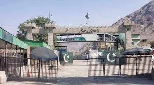
- Crossing from Pakistan at the Torkham Border
Journey to the Border from Peshawar:
- First, travel from Peshawar to the Karkhano Market, the main shared taxi station for the border. The 10 km trip costs about 350 Pakistani Rupees (PKR) or $1.20 USD using a ride-hailing app like InDrive.
- The total travel duration from central Peshawar to Kabul, including the border crossing, is a full-day affair, taking between 7 to 10 hours depending on road and security checkpoint conditions.
Pakistan Exit Formalities:
- The approach to the border involves multiple Pakistani security checkpoints where officials may thoroughly inspect luggage and, notably, check the amount of cash you are carrying.
- Critical Cash Rule: Officially, you may only carry a maximum of $1,000 USD in physical cash into Afghanistan. Any amount exceeding this is subject to confiscation or forced exchange at unfavorable rates.
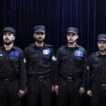
- Upon receiving your exit stamp, you will be administered an oral polio vaccination on the spot, which is mandatory for all crossers.
- Crucial Timing Consideration: Avoid planning your crossing for a Thursday. Afghan government offices are closed all day Friday. If you require any travel permits upon entry, you would be stranded at the border until Saturday.
The Physical Crossing:
- The no-man’s-land between the two posts is often chaotic, filled with trucks, porters, and pedestrians. You may walk or take a short shuttle ride through this area.
- The entire border processing sequence takes a minimum of one hour, often longer.
Afghanistan Entry & Onward Travel:
- Afghan border officers are generally polite. Present your passport and visa, answer straightforward questions about your plans, and proceed.
- Immediate Services: Right after clearing immigration, you can find currency exchangers (typically offering fair rates) and vendors selling local SIM cards (note: mobile internet is generally poor and unreliable nationwide).
- Transport Options: Shared taxis and private cars for Jalalabad or Kabul are readily available. Many travelers, especially first-timers, pre-arrange a guide or driver for safety and convenience.
- The drive from Torkham to Kabul takes approximately 4 to 5 hours.
- Crossing from Iran at the Islam Qala – Taybad Border
Travel to the Border
- From Mashhad, Iran, take a shared taxi or bus to the Dogharoun border post. The 120km journey takes about 2 hours and costs approximately $15.
Exit Iran
- At the Dogharoun customs office, present your passport for an exit stamp. Your luggage will be scanned. Officials may ask about your stay in Iran.
Cross No-Man’s Land
- You can walk or take a short vehicle ride across the neutral zone to the Afghan side at Islam Qala.
Enter Afghanistan
- At the Islam Qala immigration office, go through a security check (separate for men and women).
- Present your passport with the pre-arranged Afghan visa for an entry stamp. Officials may ask about your travel plans within Afghanistan.
- Important: Ensure your passport is stamped and the entry is logged. Politely decline any “assistance” with stamps from unofficial helpers.
Onward Travel
- From Islam Qala, it is about a 2-hour drive (120km) to Herat. Shared taxis are available.
- Crossing from Tajikistan at the Sher Khan Bandar Border
- The border gate opens at 9:00 AM sharp.
- The complete process—including obtaining a visa-on-arrival—requires patience, taking about 4 hours on average.
Journey from Dushanbe to the Border:
- Option 1 (Cheapest): Take a shared taxi from Sakhovat Bazaar in Dushanbe directly to the border. Cost: 100-150 Tajik Somoni (TJS).
- Option 2: Catch the 8:00 AM bus from Dushanbe to Dusti town (40 TJS), then a taxi from Dusti to the border (50-100 TJS).
The Detailed Visa-on-Arrival & Entry Process:
- Exit Tajikistan: A quick and simple stamp-out procedure.
- Cross the Bridge: Walking is prohibited. A mandatory jeep transports you across the bridge for 10 TJS.
- Initial Afghan Border Post: You will be interviewed and given a slip of paper authorizing you to procure a visa.
- Bank Payment in Town: Take a taxi to the center of Sher Khan Bandar town (200 AFN). Exchange money if necessary. Pay the visa fee at the designated bank—this takes about 15 minutes.
- Return to Border: Go back to the immigration office, submit your bank receipt, and fill out the visa application form. Then wait (up to 1 hour) for your passport to be processed with the visa sticker.
- Final Passport Control: Be mindful of the lunch break from 12:00 to 1:00 PM. After this, get your final entry stamp.
After Entry and Mandatory Procedures:
- To Kunduz: Shared taxis cost 200 AFN per seat; a private taxi is about 800 AFN. Travel time is around 1 hour.
- Accommodation in Kunduz: Guesthouses like the “Five Star Guest House” exist; prices are negotiated on arrival (e.g., 1500 AFN for a room).
Critical Administrative Steps:
- Ministry of Foreign Affairs Stamp: You must visit the local Ministry of Foreign Affairs office in Kunduz (which closes at 4:00 PM) to obtain a second registration stamp in your passport.
- Travel Permits: Subsequently, visit the provincial office of the Ministry of Information and Culture to obtain permits for each province you plan to visit. This can also be done in other major cities later in your journey, but it is a non-negotiable requirement for travel.
- Crossing from Turkmenistan
Two Available Border Crossings:
- Torghundi (Turkmenistan) / Serkhetabat (Afghanistan): This is the main route to Herat, featuring good asphalt roads. It may be closed in winter due to snow.
- Imam Nazar (Turkmenistan) / Aaqina (Afghanistan): A remote crossing near Andkhoy, accessible via dirt tracks that require a 4WD vehicle. There are very few recent traveler reports; its operational status must be confirmed locally with extreme diligence.
Crossing the Serhetabat (Turkmenistan) – Torghundi (Afghanistan) Border
The Serhetabat–Torghundi border crossing represents one of the most remote and infrequently traversed international frontiers in Central Asia, and possibly the world. This land link connects the Central Asian republic of Turkmenistan with Afghanistan in South Asia, specifically joining the Turkmen city of Serhetabat to Torghundi in Afghanistan’s northwestern Herat Province.
Primarily a commercial and freight corridor, this border is open to travellers only as part of pre-arranged, guided tours. It offers a rare and logistically complex opportunity to move between Central Asia and Afghanistan—a route steeped in history as part of the old Soviet rail corridor to the Indian subcontinent. Crossing here requires meticulous advance planning, official permissions, and strict adherence to the regulations of both nations.
Border Opening Hours & Operational Days
- Daily Operating Hours: 08:00 to 17:00 (daylight hours only).
- Winter Hours: In the middle of winter, the border may close as early as 15:00 due to reduced daylight.
- Lunch Break: On the Turkmen side only, a mandatory break is observed daily between 13:00 and 14:00. All processing halts during this time.
- Closures: The border is closed every Friday and on all Turkmenistan public holidays.
Practical Advice: Always confirm your specific crossing date with your tour operator. To complete all formalities, plan to arrive as soon as the border opens at 08:00.
Getting to the Border: Travel Logistics
Since independent travel is not permitted for tourists in Turkmenistan, reaching the Serhetabat border must be organised by an approved Turkmen tour company.
From Turkmenistan (To Serhetabat)
- Starting Point: Most journeys originate from Mary (Turkmenistan).
- Distance & Drive Time: Approximately 307 km, taking 6–7 hours on decent paved roads.
From Afghanistan (To Torghundi)
- Starting Point: Typically from Herat.
- Distance & Drive Time: About 125 km on a fully paved but often poorly maintained road. Due to security checks and road conditions, the journey takes 2–3 hours.
- Route Details: Reputable Afghan tour companies arrange guided car transfers with security escorts or highly experienced local drivers.
Visa Requirements: Mandatory Advance Preparation
Both countries require visas to be obtained in advance; neither issues visas at the border.
For Afghanistan:
- You must secure an Afghan visa in advance from an embassy or consulate before your journey. Ensure your visa is valid for entry at a land border.
Essential Finance: Cash-Only Crossing
- This is a cash-only frontier. Do not rely on cards or expect to find ATMs.
Entering Afghanistan (Torghundi)
Procedures are generally more straightforward for pre-arranged groups but remain strict.
- Restricted Items: Satellite phones, professional filming equipment, and large cameras (unless prior approval has been obtained).
Summary of Critical Points for All Travelers
- Cash Regulations: if you’re entering Afghanistan through Pakistan, please note you can only bring in $1,000 USD. Other borders don’t have this entry limit. However, everyone needs to be aware of one key rule when leaving Afghanistan: you cannot take more than $1,000 USD out with you, no matter which border you use. A handy tip if you have more funds: You can always exchange your extra USD into the currency of the neighboring country you’re crossing into (like Pakistani Rupees or Iranian Rial). Once you’re across the border, you can exchange it back. Just keep in mind that you’ll lose a small amount on the double exchange due to transaction fees and rates.
- Visa Strategy: Obtain an Afghan visa in advance from an embassy, or be prepared for the formal visa-on-arrival process at the Tajik border.
- Internal Travel Permits: This is imperative. After entry, you must secure travel permits from the Ministry of Information and Culture for each province. Do not travel between provinces without these.
- Friday Closures: All Afghan government offices, including those granting permits, are closed on Friday, the day of prayer.
- Daylight Hours: Borders from Iran and Uzbekistan operate on strict daylight schedules; plan arrival accordingly.
- Immediate Needs: Exchange a small amount of money and purchase a local SIM card at the border. Manage expectations regarding internet connectivity.
- Transport Philosophy: Use shared taxis for economy; negotiate firmly for private taxis. On the Iran route, shared taxis are significantly faster than buses.
- Final, Overarching Advice: Always confirm the current border status, exact opening hours, and prevailing transport prices immediately before your journey. Conditions, regulations, and accessibility in this region are subject to frequent and unannounced change.
Note: As of late 2025, all foreign travelers require a government-licensed local guide to obtain travel permit letters for provincial travel. Independent travelers cannot get permits on their own .
General Information About Afghanistan Borders:
- The Afghanistan–Iran Border
The Afghanistan–Iran border is 921 km (572 mi) in length. It runs from the tripoint with Turkmenistan in the Harirud river to the tripoint with Pakistan in the south. The formalization of this border between Qajar Iran and Afghanistan was a protracted process occurring between 1872 and 1935 by the British formalize.
- The Afghanistan–Pakistan Border (The Durand Line)
The Afghanistan–Pakistan border, known as the Durand Line, is Afghanistan’s longest and most politically charged frontier. It is a 2,640-kilometre (1,640 mi) international border. India also claims a land border with Afghanistan on the eastern end of the Durand Line, between Afghanistan’s Wakhan Corridor and the Gilgit region, which is administered by Pakistan but claimed by India as part of the disputed Kashmir region. The western end of the Durand Line runs to the border with Iran, and the eastern end to the border with China. The Durand Line was established in 1893 as the international border between the Emirate of Afghanistan and the British Indian Empire. It was negotiated by Mortimer Durand, a British diplomat, and Abdur Rahman Khan, the Emir of Afghanistan.
Geopolitically, the Durand Line cuts through to demarcate Pakistan’s Khyber Pakhtunkhwa, Balochistan, and the contested region of Gilgit-Baltistan from the northeastern and southern provinces of Afghanistan. It has been described as one of the most dangerous borders in the world. The border is 2,611 km (1,622 mi) long. Twelve Afghan provinces are located along it: Nimroz, Helmand, Kandahar, Zabul, Paktika, Khost, Paktia, Logar, Nangarhar, Kunar, Nuristan, and Badakhshan. The terrain is extremely rugged, featuring high mountains. The highest peak, Noshaq, is located along the border between the two countries, while some of the world’s highest peaks, including K2, are a short distance to the east of the Line’s end on the Pakistani side.
A critical and enduring issue is that although the Durand Line is internationally recognized as the western border of Pakistan, it remains politically unrecognized by successive Afghan governments. No Afghan government has recognized the Durand Line as its international border since 1947. This border is one of the most complicated and skirmished frontiers of Afghanistan, with multiple armed incidents occurring between Afghan and Pakistani forces over the decades.
The Treaty of Gandamak
Signed on 26 May 1879, it officially ended the first phase of the Second Anglo-Afghan War. Afghan Emir Mohammad Yaqub Khan ceded control of Afghanistan’s foreign affairs to the British Raj and surrendered frontier areas. Specifically, jurisdiction over the Korram and Pishin valleys, the Sibi district, and the Khyber Pass were transferred to the British. The treaty established the ceded territories as part of British India.
- The Afghanistan–Turkmenistan Border
The Afghanistan–Turkmenistan border is 804 km (500 mi) in length. It runs from the tripoint with Iran in the west to the tripoint with Uzbekistan in the east. The border traverses a thinly populated area consisting mostly of desert and some hills.
This border, like others in the north, was shaped during the 19th-century Great Game. In 1873, Britain and Russia agreed on a rough formulation, with the Amu Darya declared as the border east of Khwaja Salar. The western section was to be determined later. Russian expansion into Turkmenistan in the early 1880s led to the Panjdeh Incident, a crisis over an area claimed by Afghanistan. A joint Anglo-Russian boundary commission then demarcated the boundary between 1885 and 1888. As the village of Khwaja Salar could no longer be identified, it was agreed the boundary should meet the Amu Darya near Khamiab, Afghanistan. This border was inherited by the Soviet Union and later by independent Turkmenistan. A 1921 Soviet-Afghan treaty proposed handing over frontier districts to Afghanistan, but this was never implemented and was explicitly annulled by the Frontier Agreement of 1946, which maintained the existing boundary.
- The Afghanistan–Uzbekistan Border
The Afghanistan–Uzbekistan border is 144 km (89 miles) long, making it the shortest external border of Uzbekistan. It stretches from the Turkmenistan tripoint in the west to the Tajikistan tripoint in the east. The entire border follows the thalweg of the Amu Darya (Oxus) River. The closest major population centers are Termez in Uzbekistan and Hairatan in Afghanistan, which form the most important contact point.
Historically, its origins lie in the 19th-century Great Game agreements. The 1873 Anglo-Russian agreement established the Amu Darya as the boundary. Following the Panjdeh Incident, a joint commission finalized the border between 1885 and 1888. The eastern section was settled between 1893 and 1895, with Emir Abdur Rahman Khan relinquishing claims north of the river.
- The Afghanistan–Tajikistan Border
The Afghanistan–Tajikistan border is 1,357 km (843 miles) long, extending from the Uzbekistan tripoint in the west to the China (Xinjiang) tripoint in the east. It is the longest of Afghanistan’s northern borders. Most of the border follows natural waterways: the Amu Darya, Pyanj, and Pamir Rivers. The eastern section crosses the mountainous Wakhan Corridor. This boundary also divides the ethnic Tajik population between the two states.
The border was shaped during the Great Game. The 1873 Anglo-Russian agreement designated the Amu Darya as the boundary. After the Panjdeh Incident, a joint commission finalized most of the border between 1884 and 1887. The eastern section in the Wakhan Corridor was defined between 1893 and 1895 to create a buffer between the British and Russian empires.
- The Afghanistan–China Border
The Afghanistan–China border is a 92-kilometre-long (57 mi) boundary. It is located in the far northeast of Afghanistan, at the end of the long, narrow Wakhan Corridor. The border begins at the tripoint with Pakistan (Gilgit-Baltistan), follows the watershed along the Mustagh Range, and ends at the tripoint with Tajikistan. The Chinese side is in the Chalachigu Valley within the Taxkorgan Tajik Autonomous County of Xinjiang. Both sides are protected areas: Wakhan National Park on the Afghan side and Taxkorgan Nature Reserve on the Chinese side. The border is marked by several high mountain passes, including Wakhjir Pass and Tegermansu Pass. This border also marks the greatest terrestrial time zone difference on Earth, with a 3.5-hour difference between Afghanistan’s UTC+04:30 and China’s UTC+08:00.
Historically, the area was a Silk Road thoroughfare. The border was established between the British and Russian empires in 1895 as part of the Great Game, but China and Afghanistan did not formally agree on it until 1963, when the Kingdom of Afghanistan and the People’s Republic of China demarcated their border. The border is remote and closed. In the 2000s, Afghanistan asked China on several occasions to open the border for economic reasons or as an alternative supply route, but China resisted, largely due to unrest in Xinjiang. By 2025, the Chinese military had set up a high green fence along the border and multiple large barracks.
Afghanistan’s borders are a complex tapestry woven from the threads of 19th-century imperial rivalry, 20th-century superpower conflict, and 21st-century geopolitical and security challenges. Each frontier—the contentious Durand Line with Pakistan, the economically vital borders with Iran and the Central Asian states, and the remote, closed border with China—carries its own distinct history, function, and set of problems. The crossing points, from the bustling truck stops of Islam Qala and Torkham to the strategic Friendship Bridges in the north and the remote, inhospitable passes of the Wakhan, are the practical nodes where policy, economy, and people meet.
Let’s Go Afghanistan Team